content-left-bg.png
content-right-bg.png

Maps and transport

WebPartZone1_1
PublishingPageContent

​There is a location map for the school available on the Contact us page. This shows where the school sits in the Bracken Ridge area.

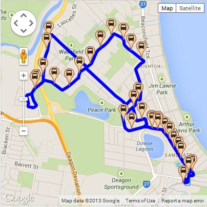
For bus transport information there are further maps available on the Translink website.

Routes to view on the translink site may include 311 which travels between Sandgate train station and Barfoot Street to the school.

Translink map of a bus route. More information is on the Translink website.


WebPartZone1_2
WebPartZone2_1
WebPartZone2_2
WebPartZone2_3
WebPartZone3_1
WebPartZone3_2
WebPartZone3_3
WebPartZone3_4
WebPartZone4_1
WebPartZone5_1
WebPartZone5_2
WebPartZone6_1
WebPartZone6_2
WebPartZone7_1
WebPartZone7_2
WebPartZone8_1
WebPartZone8_2
WebPartZone9_1
Last reviewed 30 March 2022
Last updated 30 March 2022